


Folk Voting District, Osage County, Missouri
About
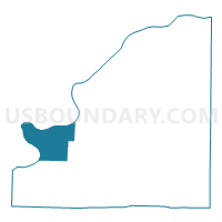
Outline

Summary
| Unique Area Identifier | 609284 |
| Name | Folk Voting District |
| County | Osage County |
| State | Missouri |
| Area (square miles) | 29.78 |
| Land Area (square miles) | 28.92 |
| Water Area (square miles) | 0.86 |
| % of Land Area | 97.10 |
| % of Water Area | 2.90 |
| Latitude of the Internal Point | 38.43598100 |
| Longtitude of the Internal Point | -92.08247790 |
Maps


Graphs
Select a template below for downloading or customizing gragh for Folk Voting District, Osage County, Missouri


Neighbors
Neighoring Voting District (by Name) Neighboring Voting District on the Map
- Koeltztown Voting District, Osage County, MO
- Meta Voting District, Osage County, MO
- Taos Voting District, Cole County, MO
- Wardsville Voting District, Cole County, MO
- Westphalia Voting District, Osage County, MO
Top 10 Neighboring County Subdivision (by Population) Neighboring County Subdivision on the Map
- Liberty township, Cole County, MO (7,330)
- Osage township, Cole County, MO (4,179)
- Washington township, Osage County, MO (3,434)
- Jackson township, Osage County, MO (1,376)
Top 10 Neighboring Unified School District (by Population) Neighboring Unified School District on the Map
Top 10 Neighboring State Legislative District Lower Chamber (by Population) Neighboring State Legislative District Lower Chamber on the Map
Top 10 Neighboring State Legislative District Upper Chamber (by Population) Neighboring State Legislative District Upper Chamber on the Map
Top 10 Neighboring 111th Congressional District (by Population) Neighboring 111th Congressional District on the Map
Top 10 Neighboring Census Tract (by Population) Neighboring Census Tract on the Map
- Census Tract 201.98, Cole County, MO (7,324)
- Census Tract 202, Cole County, MO (4,158)
- Census Tract 4903, Osage County, MO (3,536)